 Southern California


The 35 Weird Geography Facts about Southern California That You Should Know
35 colossal scale of San Bernardino county, geographical giant, stretches from LA Basin to Nevada & Arizona state borders

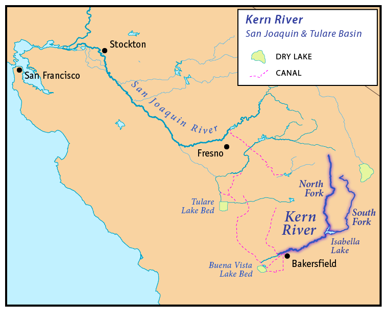
34 Relentless power of killer Kern River Few rivers in world flow almost due south from Mt Whitney in Sierra Nevada mts to valley floor, drops 12000 ft. Essential for development of agriculture in the Central Valley
33 Accidental sea of Imperial County, Salton Sea due to 1905 flooding Colorado River breached irrigation canal for 2 years

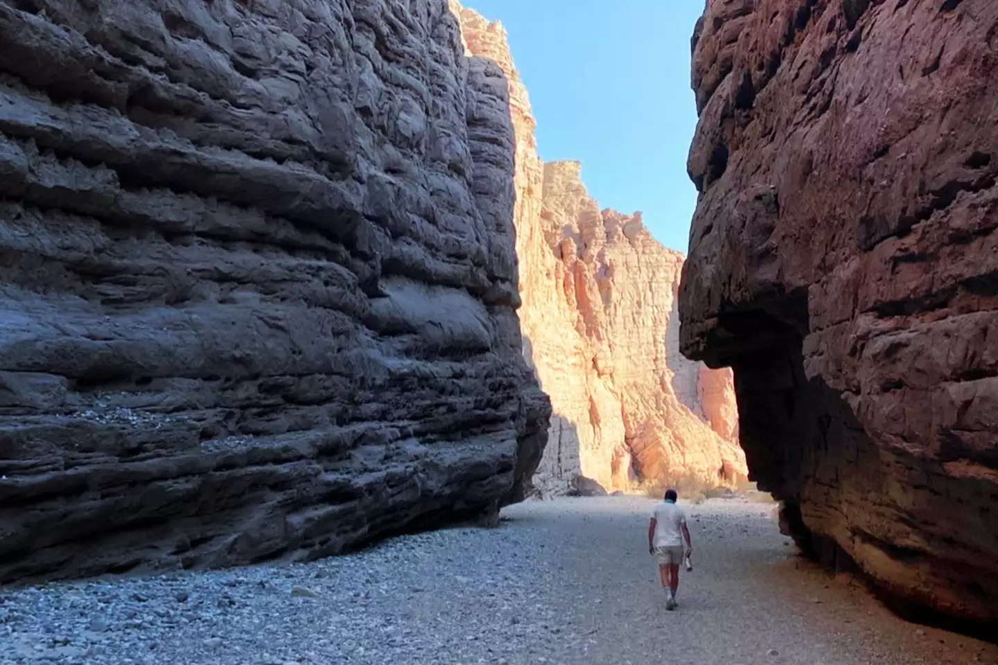
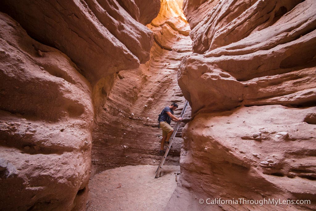
32 Infinite reach San Diego desert, Anza-Borrego State Park, largest in CA, 2nd largest in lower 48 covering over 600,000 acres. Historic route for Spanish explorer deAnza in late 1700s. Geologists founds fossils of ancient mammoths and giant sloths proving once was lush savannah

31 sideways Santa Barbara coast caused by transverse range that wa rotated 90deg over millions of years due to tectonics of San Andreas fault

30 sheer weight of L.A. population - 10 million

29 The Wedge, wave mechanics due to massive rock jetty at entrance of Newport Harbor

28 Arabian desert of Riverside county contains Coachella Valley, northern extension of Sonoran desert. Palms shoots from Middle East & N Africa imported in early 20th century flourished here. 95% of all dates grown in US are here. Deep aquifers beneath desert floor provide water for sustainable groves & golf courses

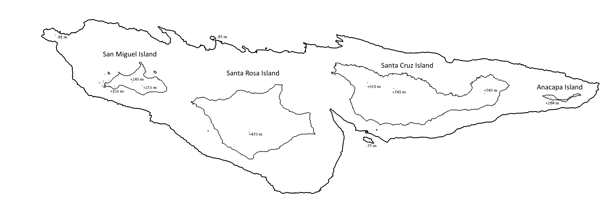
27 The drowning mountains of Venture County serve as gateway to Channel Islands National Park. These islands are highest points of Santa Monica Mountains,

26 San Luis Obispo ancient fire - Morro Bay & Morro Rock

>25Kern County black gold - oil 70% of oil of CA


24 Lawless geography of Imperial county, Slab City; once former WW2 USMC Camp Dunlap military base was decommissioned, the concrete slabs were left behind, attracting a community of squatters, artists, and retirees who live entirely off the grid

23 Gaviota Pass and wind funnel, overturns high-profile vehicles US 101; vital route for Native American communities, natural passage between inland valleys and the coastline

22 Laguna Mountains of San Diego county, alpine over 6000 ft, striking geographical contrast where snowy alpine environments exist just an hour away from the warm Pacific beaches; headwaters of three perennial streams begin in the Laguna Mountains: Noble Creek, Cottonwood Creek, and Kitchen Creek

21 Asphalt grave of Rancho LaBrea tar pits & museum, Ice age in urban environment; 5801 Wilshire Blvd., Los Angeles, CA 90036, 213.763.3466


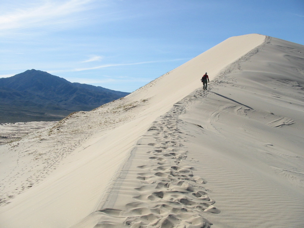
20 Shifting Seas of Algadones Dunes, the portion managed by the Bureau of Land Management is the Imperial Sand Dunes Recreation Area, Imperial County at MX border
 dunes from ISS
19 Vertical desert wall of San Jacinto mountain, Rivrside County, famous for having one of the most abrupt and steepest vertical rises in North America. The Cactus to Clouds Trail (C2C) begins in Palm Springs and ascends to San Jacinto Peak. Net elevation gain roughly 10,300 ft in 16 miles.

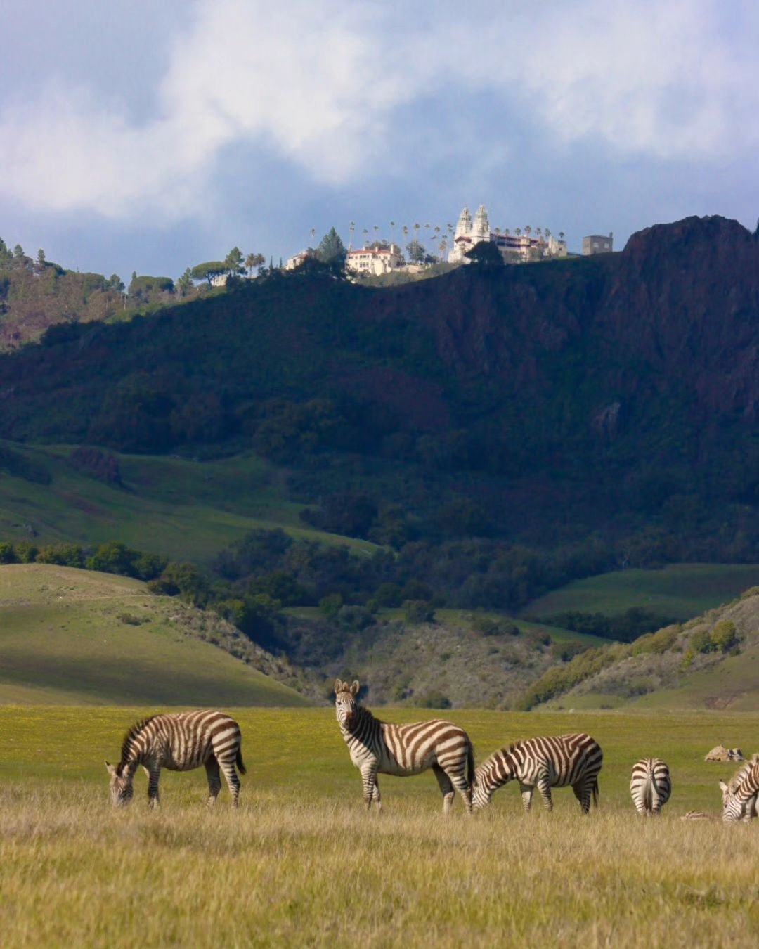
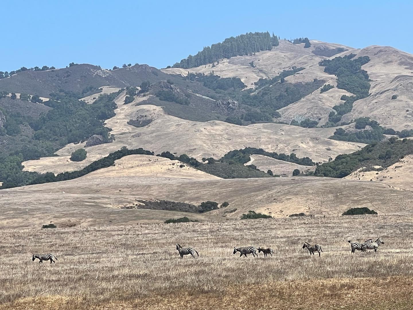
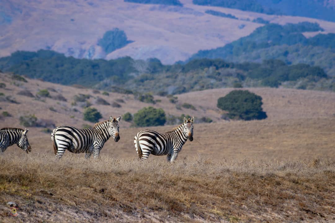
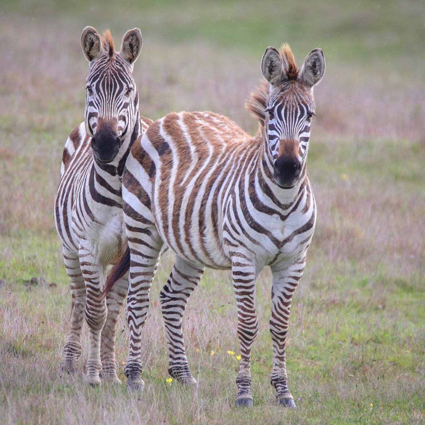
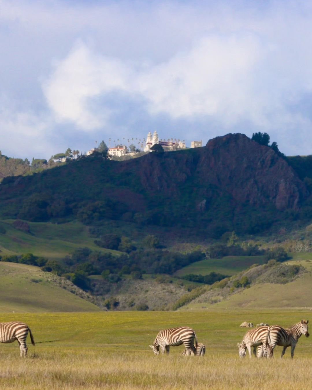
18 African dazzel of San Simeon, San Luis Obispo Couty, wild zebras

17 Tectonic Gate of El Cajon pass SCEC, between San Bernardino Mts and San Gabriel Mts, directly over San Andreas Fault

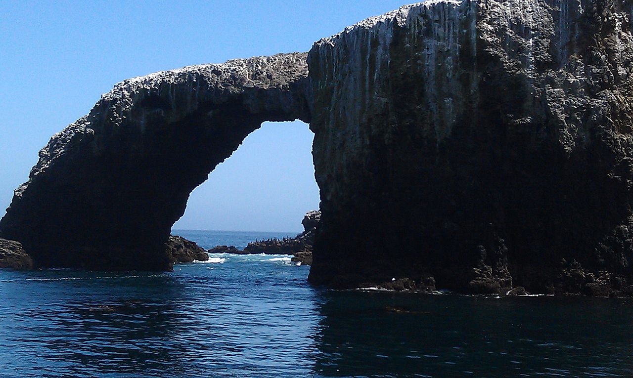
16 Volcanic islands of Anacapa Island, Ventura county, 3 small volcanic islands of Channel Islands famous for towering sea cliffs and a massive natural bridge known as arch rock that was carved by the relentless force of Pacific waves over thousands of years. These dramatic formations give the island a striking and almost otherworldly appearance when viewed from the ocean. Geography of the island provides a critical nesting ground for the largest breeding colony of California brown pelicans in the world, making it an essential site for bird conservation.


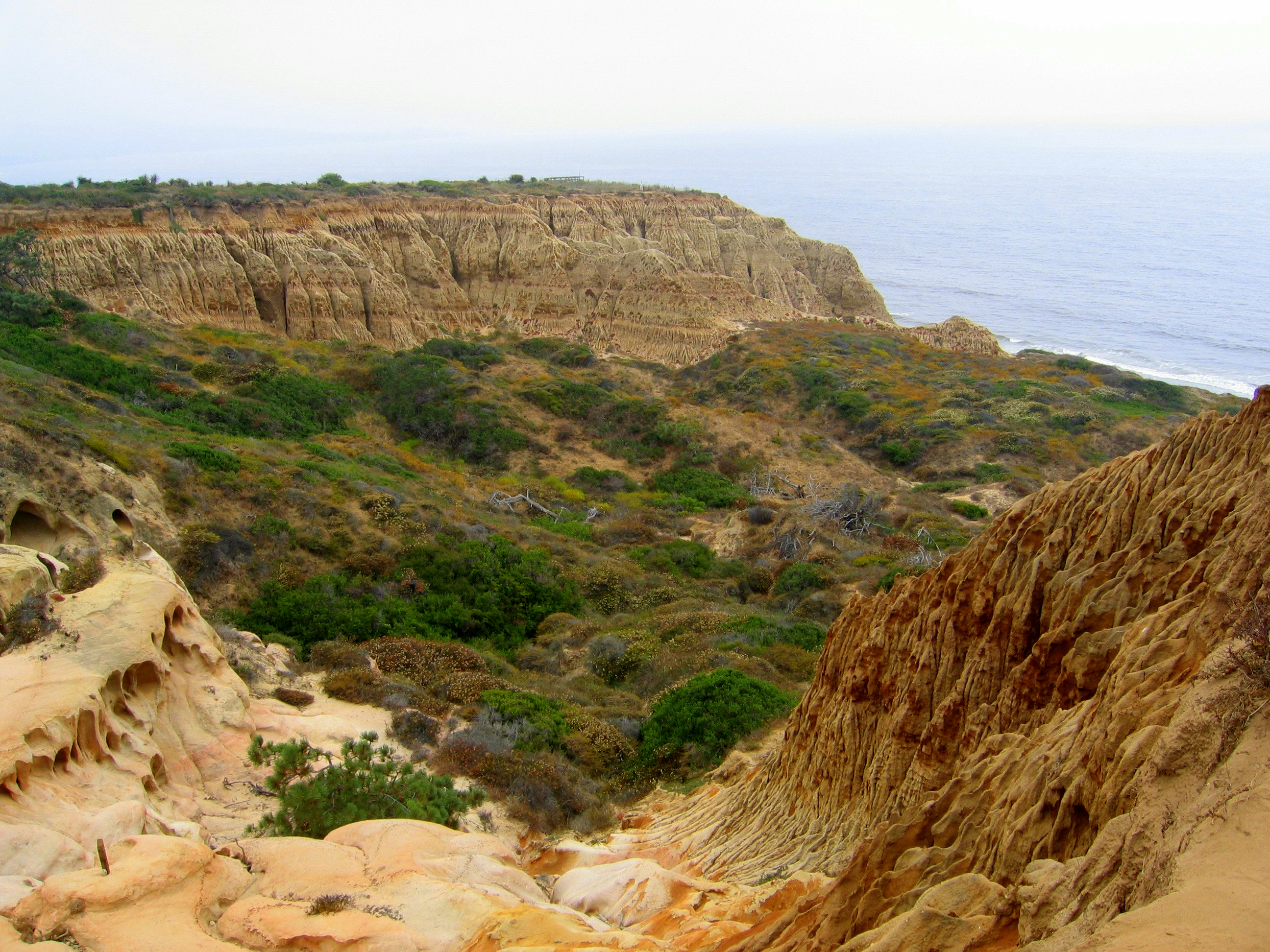
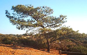
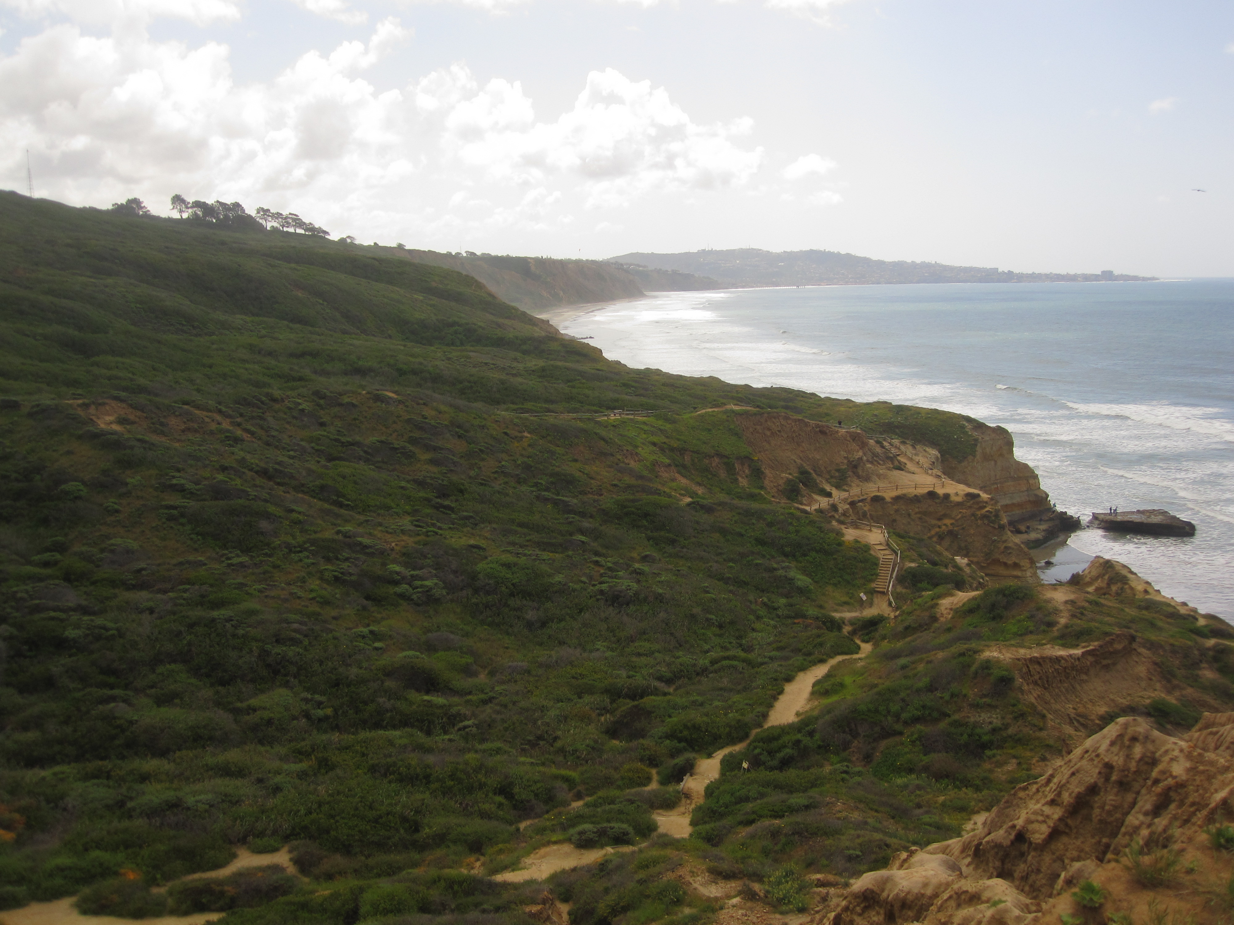
15 Last stand of the Torrey Pine, critically endangered species at State National Reserve in San Diego county, only other location Santa Rosa Ialand of Channel Islands

14 Booming echoes of the Kelso Dunes, Mojave National Preserve, San Bermardo county, "Singing Sands"

13 Underwater Wilderness of Cove State Park, Orange County, giant kelp forest


12 Great rupture of Fort Tejon, Kern County, 1857 massive earthquake, causes Kern R to flow backwards several miles. "Although the epicenter or starting location of the earthquake was near Parkfield, the event is referred to as the Fort Tejon earthquake, because that was the location of the greatest damage. Fort Tejon is just north of the junction of the San Andreas and Garlock Faults, where the Tehachapi, San Emigdio, and Sierra Pelona Transverse Ranges come together." homesteadmuseum.blog/2023/01/09/shake-rattle-and-roll-the-last-big-one-in-southern-california-the-fort-tejon-earthquake-of-9-january-1857/


 Los Angeles Star, 10Jan1857
11 Tilted walls of Devil's Punch Bowl, LA County, vertical sandstone formation upright due to San Andreas fault, offers a direct look at the raw power of plate tectonics and how it can reshape the surface of the Earth. The sandstone layers actually contain fossils from the Meiosene epic when the area was covered by a shallow sea
 Devil's Chair;
 Panorama of Devil's Punchbowl fro Devil's Chair;
 Manzanita;
 rock formation, 2023, shows regrowth after
2020 Bobcat Fire
360 deg
rock formation, 2023, shows regrowth after
2020 Bobcat Fire
360 deg

10 Accidental inland sea, Salton Sea area of Imperial & Riverside counties, 200 ft below sea level, 1905 breach Colorado R, very saline. Sonny Bono Salton Sea National Wildlife Refuge.
 waterfowl at Hazard Ponds;
 burrowing owls;
 lesser nighthawk;
 bobcat
 Snow geese with Rock Hill in background
09 Kelp forests of the Channel Islands; underwater geography of the Channel Islands off the coast of Santa Barbara and Ventura counties supports vast giant kelp forests. These marine ecosystems are among the most productive on Earth, providing shelter and food for thousands of different species of fish and invertebrates
 kelp;
kelp;
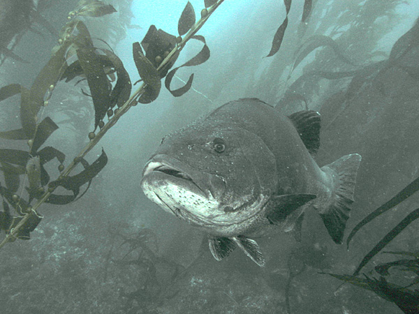 giant black sea bass;
 Moray eel;


08 Red Rock Canyon Spires, Red Rock Canyon St Park, Kern County, colorful layers of white, pink, and red sandstone were created by ancient volcanic activity and the deposition of minerals in a large lake basin. These dramatic cliffs served as a major landmark for early pioneers traveling along the 20 mule team freight routes through the desert
 ;
;
 prominent rock formation near park entrance;
 1930s;
 1999 road in foreground;
 hoodoos;
 alluvial plain


 El Morro seen from Morro Bay State Park
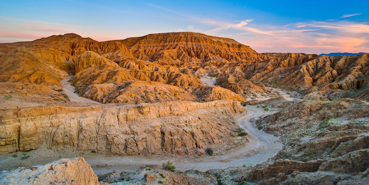
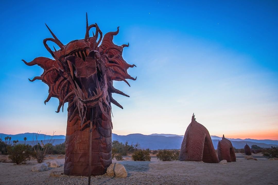
**** I must add Galleta Meadows
 park sign


 Telegraph peak
 Telegraph 8985'L Cucamonga 8869'C Ontario8693'R seen from Baldy Bowl on Mount San Antonio (Mt Baldy)
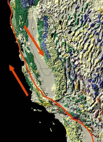
01 San Andreas Fault Engine, San Bernardino county & Kern county. A continental right-lateral strike-slip transform fault that extends roughly 750 mi (1,210 km) through the U.S. state of California. It forms part of the tectonic boundary between the Pacific plate and the North American plate. The average slip rate along the entire fault ranges from 0.79 to 1.38 inches (20 to 35 mm) per year.


 USGS diagram
 aerial over Carrizo Plain
 NASA Jet Propulsion Laboratory. - NASA Earth Observatory
Much of the length of the San Andreas Fault is lined by a distinct trough. This false-colour radar image shows a section of the fault west of San Francisco Bay; the Crystal Springs Reservoir fills the trough that marks the underlying fault. The black line curving along the east side of the fault is I-280, and California highway 92 runs from the top right across to the centre left of the image, heading towards Half Moon Bay to the west. San Mateo and Burlingame are parts of the large urbanized area in various tones of pink and green, and Foster City is the area of curved streets extending out into the San Francisco Bay at the top right.
NASA Jet Propulsion Laboratory. - NASA Earth Observatory
Much of the length of the San Andreas Fault is lined by a distinct trough. This false-colour radar image shows a section of the fault west of San Francisco Bay; the Crystal Springs Reservoir fills the trough that marks the underlying fault. The black line curving along the east side of the fault is I-280, and California highway 92 runs from the top right across to the centre left of the image, heading towards Half Moon Bay to the west. San Mateo and Burlingame are parts of the large urbanized area in various tones of pink and green, and Foster City is the area of curved streets extending out into the San Francisco Bay at the top right.
 Tectonic evoluation of the San Andreas Fault